Welcome in Walschbronn
Weckersburg Castle
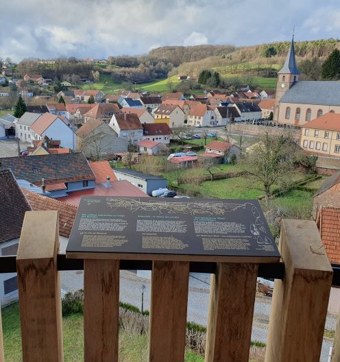
Location of the site
The castle is built on the western slope of the Schankenberg hill. The site does not appear to be very favourable: although the slope is steep to the south and west, it is dominated by the rest of the mountain to the north. Nevertheless, it is a genuine fortified castle, i.e. a fortified residence of the nobility adapted to the use of artillery. It is located at the crossroads of two routes; its role is to control the road between Bitche and Pirmasens.
Walschbronn or Weckersbourg ?
The origin of the castle is based on two versions. The first is that it was built in 1490 by Earl Simon Wecker of Deux-Ponts-Bitche († 1495). The second version is that it was built between 1520 and 1540 by Earl George Wecker of Zweibrücken-Bitche and Ochsenstein († 1559). Called " Waldsborn " or " Walsspurn " in ancient spring, it was nicknamed " Weckersburg " in the second half of the 19th century.
Its desertion
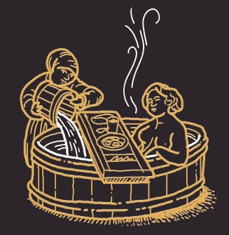
In 1541, the castle was inherited by Jacques de Deux-Ponts-Bitche († 1570), but he had little interest in it and no longer maintained it. He also abandoned the thermal springs (" Badehaus und Bad "), even though they were still renowned at that time. In 1577, the castle was in a sad state: the roofs began to rot. The following year, all its wooden elements were sold, the site fell into disrepair.
A rebuilding ?
Around 1744, the French authorities planned to rehabilitate the castle to make it a defensive and observation post at the entrance to the valley which gave access to the Bitche region from the nearby Palatinate. In particular, the aim was to "prevent the exit of grain and smuggling through this part of the valley". It was felt that, once it was rehabilitated, it could not be conquered without cannons. But the site was not rehabilitated and its stones were used for the construction of houses and the surrounding wall of the cemetery.
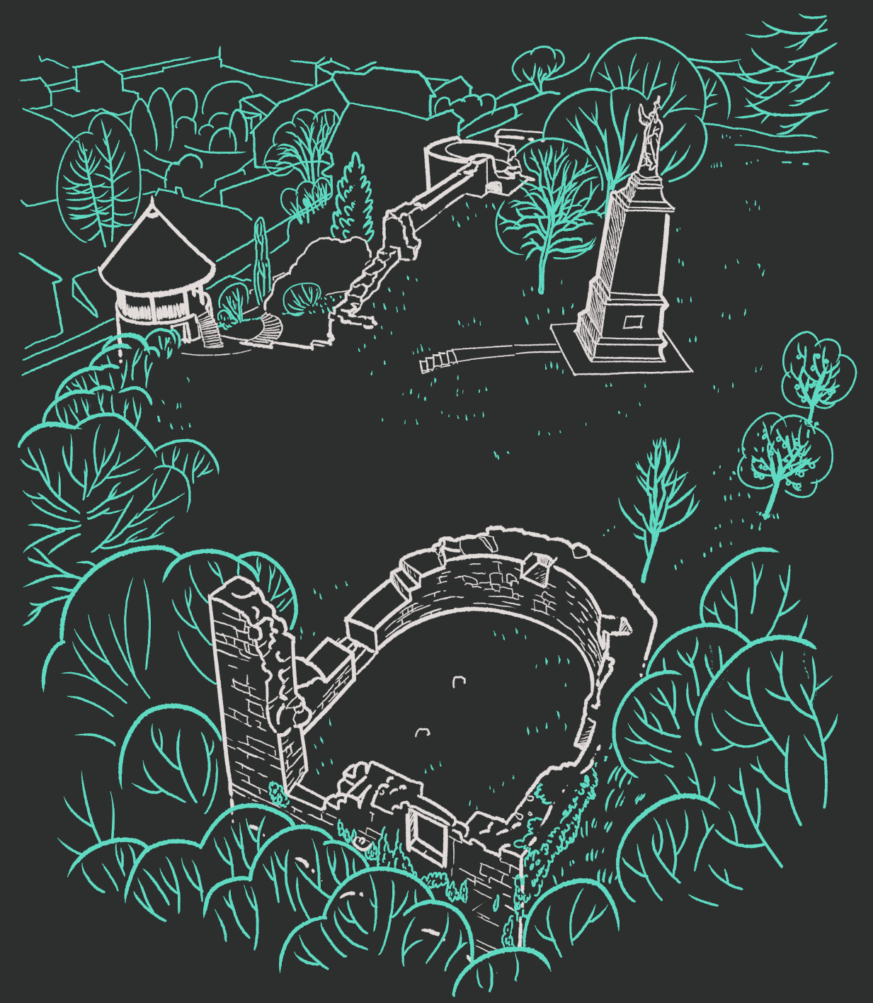
The remains
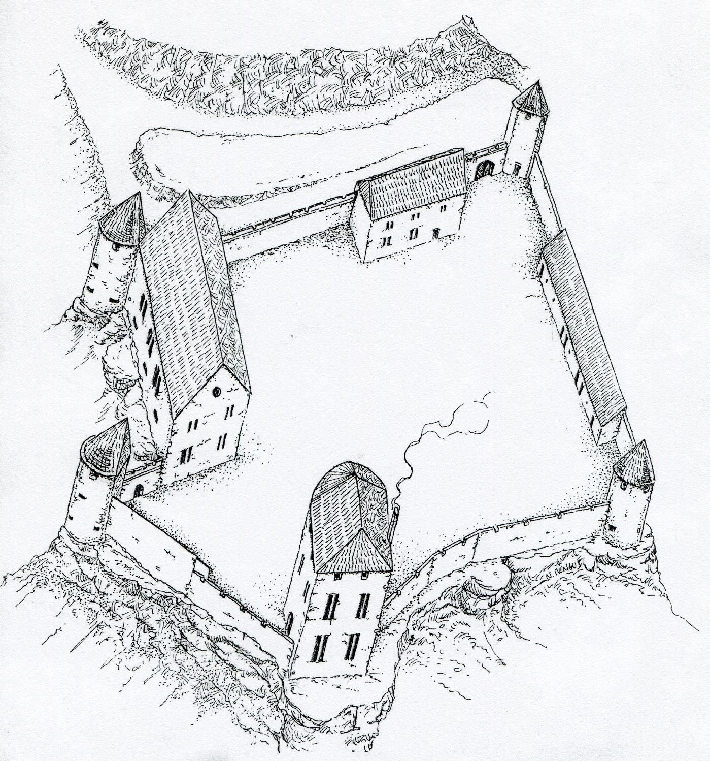
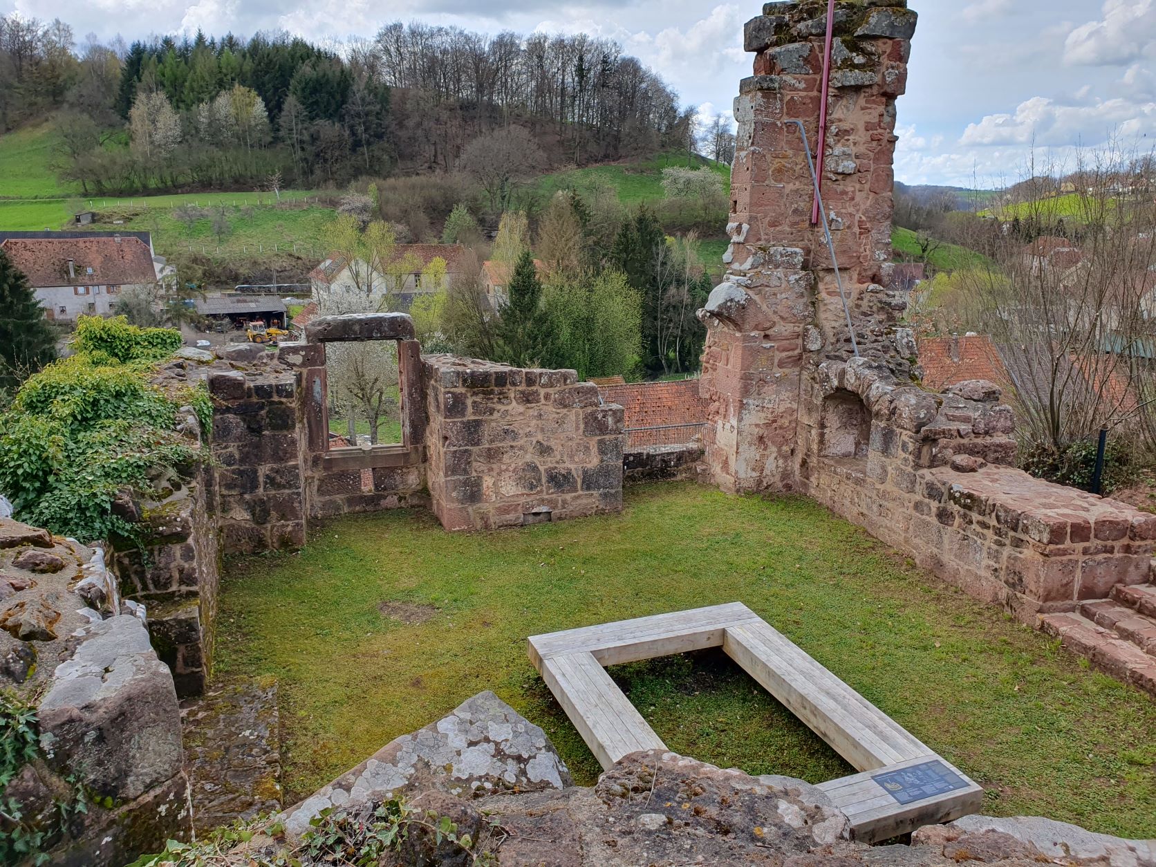
The visible remains, which have now been repaired, consist of two large circular towers used for artillery purposes and the lower part of a seigneurial dwelling in the shape of a horseshoe. The site having been largely flattened to the north-east and east, the old ditch is no longer visible.
According to a plan of 1758, the entrance to the castle was located in the north-east corner. It was flanked by a small building attached to the northern wall. To the north-west, the surrounding wall is still well preserved. The plan of 1758 shows that a building was attached to it. It is connected to a circular flanking tower. The three openings are suitable for the use of light firearms, such as the Handbüchsen and Hackenbüchsen. The one to the north-east is blocked by the fact that the original circulation level has been covered by earth. In 1828, an upper level remained, which was clearly also equipped with cannons.
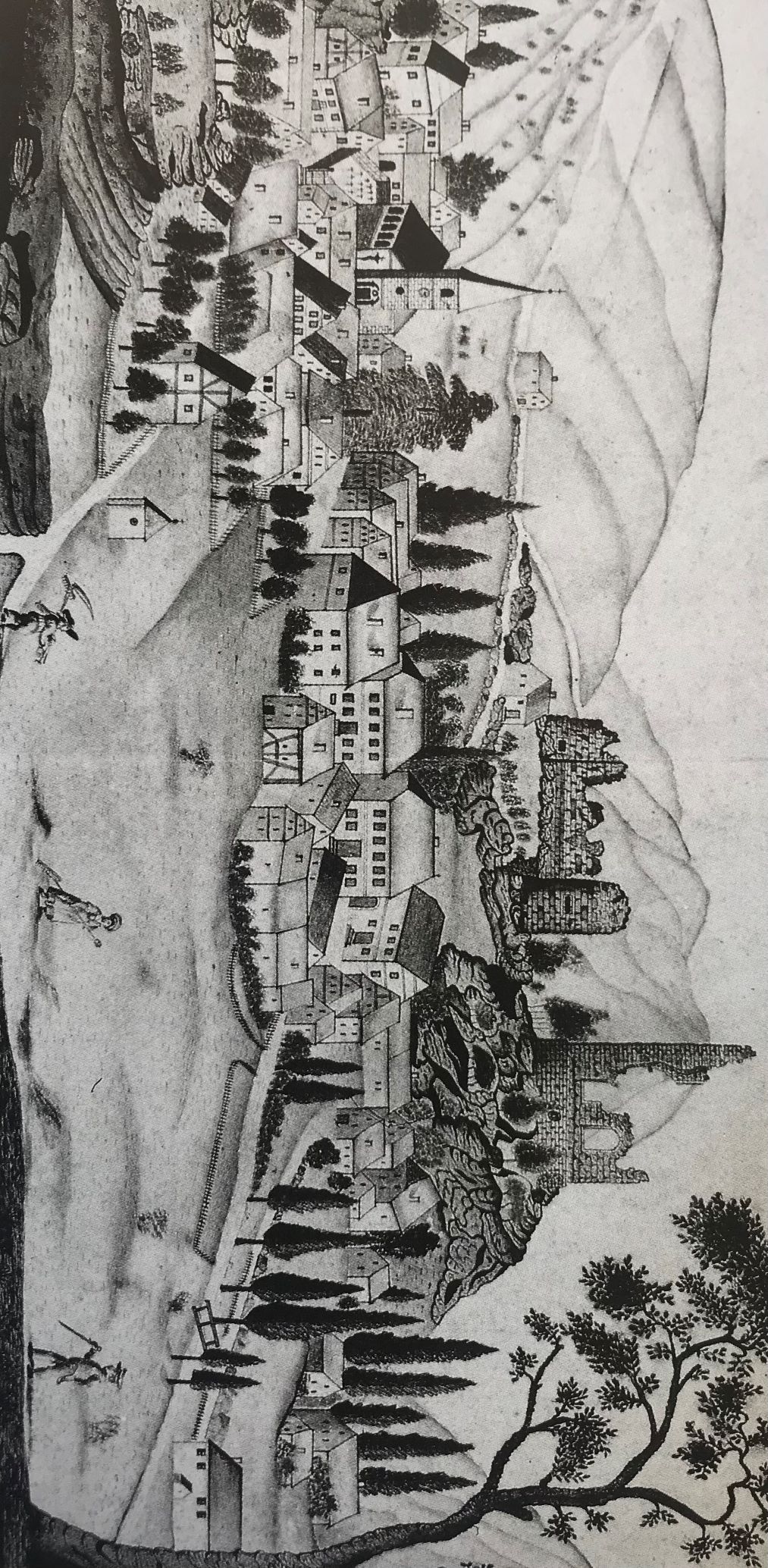
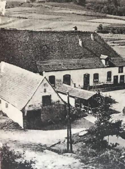
Kept in the municipal archives of Sarreguemines, this naive drawing, dated 1828 and signed Chenot, gives a view of the village that has changed considerably since the Second World War. The church stands amidst large multi-storey houses, some of which have preserved the timber panelling on the gable walls; in the background, the still imposing ruins of the castle (Le pays de Bitche, images du patrimoine, Marie-France Jacops, Jacques Guillaume, Didier Hemmert, Metz, 1990, page 132).
Further west is a second circular flanking tower. Its lower level is pierced by three firing openings, also suitable for the use of couleuvrines. According to the plan of 1758, a building was attached to the neighbouring rampart.
A large horseshoe-shaped dwelling (11.20 x 8m) occupies the southern end of the site. Only the base remains, except for the south-western corner, which retains a height of two storeys. It is accessed through a doorway on the west side. To the right as you enter, at the south-west corner, is a firing niche. It has a narrow, rectangular firing opening for the use of light firearms. A similar, less well-preserved niche can be seen on the opposite wall. Two other niches can be seen on the upper level, in the rounding of the house. The southern façade retains the remains of two large windows. The trace of another window can be seen on the second floor. Opposite the entrance, in the eastern wall, is the site of a fireplace.
Conservation
The conservation of its heritage has always been one of Walschbronn's priorities, particularly where the ruins of the Weckersburg are concerned.
In 2021-2023, one of the most important restorations in its history took place. This operation involved the installation of scenographic features on the site of Weckersburg Castle and was part of a wider operation that began in September 2020 with the Northern Vosges Regional Natural Park, namely the maintenance, security and enhancement of Weckersburg Castle.
- The east tower has been raised with a timber frame and a roof to cover and protect the sandstone masonry, create a sheltered area open to the public, and design mediation tools to help visitors discover the panoramic view and educational activities.
- The stonework has been consolidated and made safe.
- Bilingual French-German visitor reception and mediation facilities have been integrated into the garden and ruin to make it more attractive to tourists.
- The garden has been landscaped to encourage the use of local species.
These works were motivated by the desire to open up the site to visitors. In this context, the town's ambition was to preserve this major heritage site in the Pays de Bitche, promote its tourist appeal in the heart of the Vosges du Nord massif and pass it on to future generations.
The project was part of a rational approach to cultural and tourist development supported by the Northern Vosges Regional Natural Park and the Pays de Bitche Community of Communes. The preservation, appropriation and understanding of this heritage required a comprehensive approach combining conservation and mediation.
Today, the site has become a must-see in the Pays de Bitche. Many tourists and hikers come here to discover our heritage, thanks in particular to the promotion carried out by the leaflet in shops and Tourist office of Pays de Bitche and this website.
The success of this project was made possible thanks to the technical support of the Northern Vosges Regional Natural Park and the editorial and historical support of the SHAL du Pays de Bitche...
... But also, and above all, thanks to our financial partners:
To learn more
- Pfälzisches Burgenlexikon, Bd. IV/2, Kaiserslautern, 2007, p.200-211
- RUDRAUF Jean-Michel, « Walschbronn. Le dernier et éphémère château des comtes de Deux-Ponts-Bitche », La Revue du Pays de Bitche n°12, 2011, p.50-58